Has District (Rrethi i Hasit)
Has District, besides the town of Krumë, comprised a number of villages, Has is located in the border of Albania and Kosovo. The ethnographic region of Has is much wider than Has District, as the region extends beyond the Albania-Kosovo border to the gates of the Kosovo cities of Prizren and Gjakova.
The district consisted of the following municipalities:
* Fajzë
* Gjinaj
* Golaj
* Krumë
Map - Has District (Rrethi i Hasit)
Map


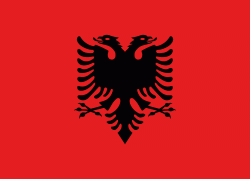
Country - Albania
 |
 |
| Flag of Albania | |
Albania has been inhabited by different civilisations over time, such as the Illyrians, Thracians, Ancient Greeks, Romans, Byzantines, Venetians, and Ottomans. The Albanians established the autonomous Principality of Arbër in the 12th century. The Kingdom of Albania and Principality of Albania formed between the 13th and 14th centuries. Prior to the Ottoman conquest of Albania in the 15th century, the Albanian resistance to Ottoman expansion into Europe led by Skanderbeg won them acclaim over most of Europe. Albania remained under Ottoman rule for nearly five centuries, during which many Albanians (known as Arnauts) attained high-ranking offices in the empire, especially in the Southern Balkans and Egypt. Between the 18th and 19th centuries, cultural developments, widely attributed to Albanians having gathered both spiritual and intellectual strength, conclusively led to the Albanian Renaissance. After the defeat of the Ottomans in the Balkan Wars, the modern nation state of Albania declared independence in 1912. In the 20th century, the Kingdom of Albania was invaded by Italy, which formed Greater Albania before becoming a protectorate of Nazi Germany. Enver Hoxha formed the People's Socialist Republic of Albania after World War II, modeled under the terms of Hoxhaism. The Revolutions of 1991 concluded the fall of communism in Albania and eventually the establishment of the current Republic of Albania.
Currency / Language
| ISO | Currency | Symbol | Significant figures |
|---|---|---|---|
| ALL | Albanian lek | L | 2 |
| ISO | Language |
|---|---|
| SQ | Albanian language |
| EL | Greek language |